Show the map
Gijymonte 2020 - 30 km
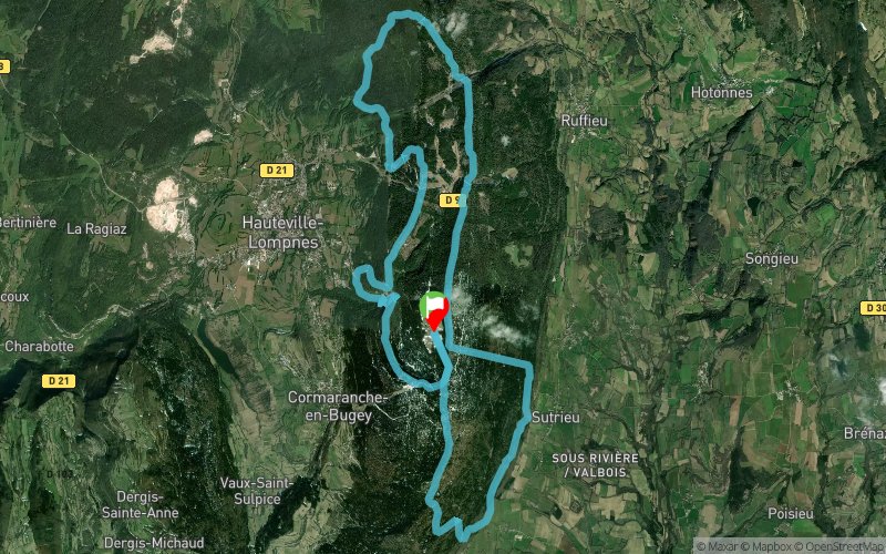


27.1 km
1690 m
1700 m
 Cormaranche-en-Bugey (01)
 Points of Interest table
| Accum. | Intermediary | |||||||
|---|---|---|---|---|---|---|---|---|
| POI | Description | Alt. | Dist. | D+ | D- | Dist. | D+ | D- |
 Competition organized on 09/19/2020
Trace n°127719
Ascent threshold : 10 m Distance threshold : 30 m Smoothing : No Origin of altitudes : MNT Aster GDEM
Ascent threshold : 10 m Distance threshold : 30 m Smoothing : No Origin of altitudes : MNT Aster GDEM
Loop
Dominant terrain : Footpath
Max alti. : 1246 m
Avg alti. : 1049 m
Min alti. : 672 m
Longest ascent : 520 m
Longest descent : 510 m
Dominant terrain : Footpath
Max alti. : 1246 m
Avg alti. : 1049 m
Min alti. : 672 m
Longest ascent : 520 m
Longest descent : 510 m
Elevation profile
More tools
Create a new roadbook page
Map and track on your website
Warning ! When you insert a Trace de Trail map on your website, you agree not to hide any element of the module (links to Trail Trail or Trail Connect banner)
Add a realisation
Validate
Add a realisation to share your chrono and describe the conditions that you encountered during you trail running !
Add a comment
Validate
PaulineBillion
27/05/22, 17:28:58
La trace entre le 8 et 10ème km n'est pas "réelle". Le dénivelé positif est plutôt aux alentours de 1400 à 1500m au total.
27/05/22, 17:28:58
La trace entre le 8 et 10ème km n'est pas "réelle". Le dénivelé positif est plutôt aux alentours de 1400 à 1500m au total.
Show the infos
Add a track